
Fire Data Insights
Descriptive analytics software to help forest fire managers make effective operational decisions while ensuring the safety of firefighters and the community. FDI software uses onboard aircraft GPS and accelerometer to track and analyze aircraft behaviour and efficiency.
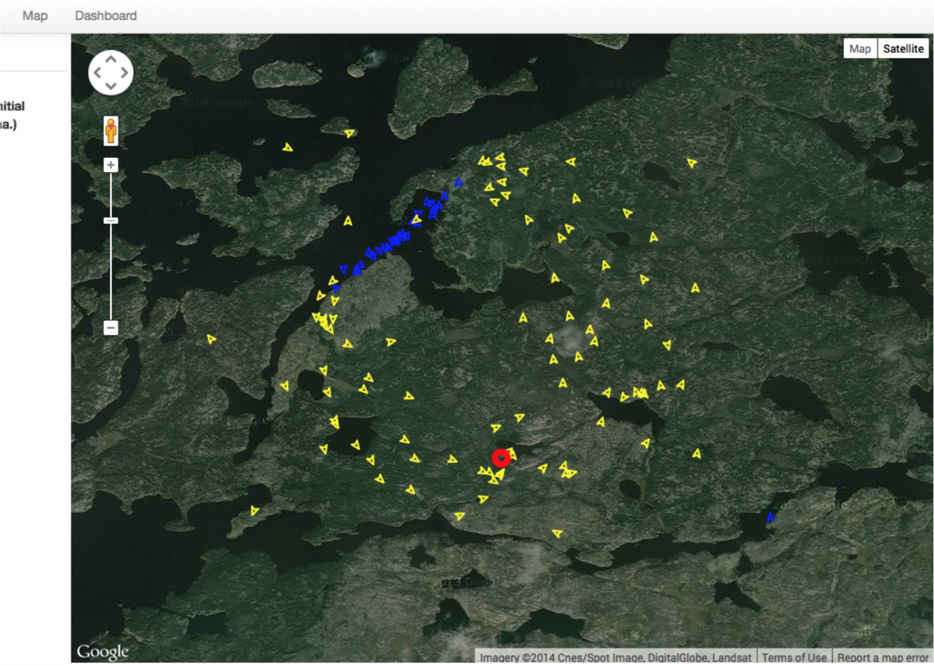
A map overview of a single aircraft’s path while fighting a fire. The blue triangles are when the aircraft is picking up water, and the red circle is the center of the fire they are actively fighting.
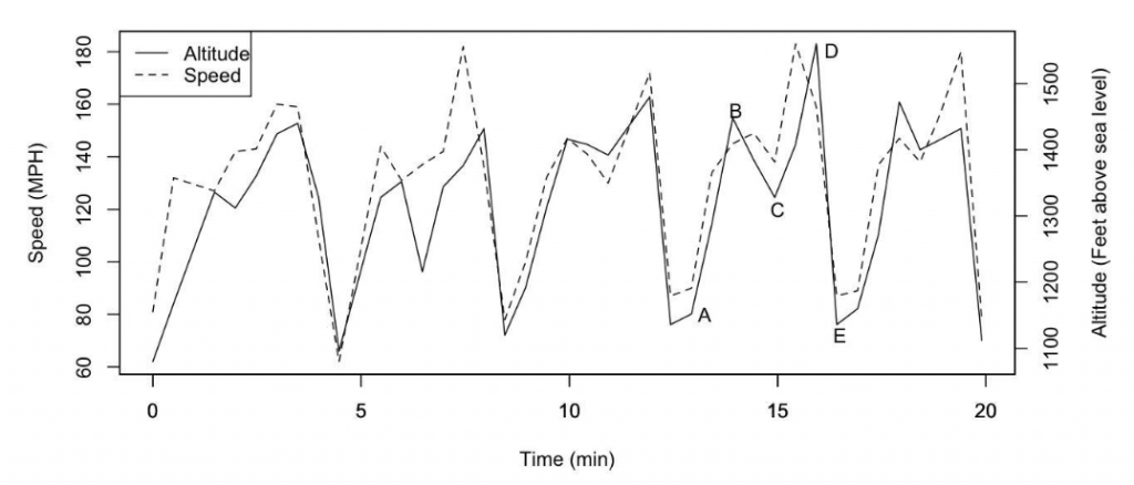
An example of the data extracted from the onboard aircraft. FDI models the behaviour of the aircraft to understand what it’s doing and how its efficiency could be improved.
We showed off this software at OCE Discovery.